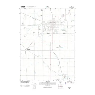
2010 Map of Bryan
USGS Topo · Published 2010About this map
Bryan serves as the primary hub of activity in this part of Williams County, organized by a rigid grid of streets such as S Union St and Paige St. The surrounding landscape is defined by the winding paths of Lick Creek and its tributary, Little Lick Creek, which contrast with the straight lines of the rural road network. Outside the city center, several residential developments like Jerrys First Addition, Rachel Heights, and Bona Vesta show the expansion of the community into formerly agricultural land. For those interested in the area's ancestry, numerous burial grounds are documented, including Brown Cemetery, Fetters Cemetery, and Williams Center Cemetery. To the south, the village of Ney is situated at the confluence of Lick Creek and Prairie Creek, while the Williams County Airport sits on the eastern edge of the quadrangle, highlighting the infrastructure of the early 21st century.
Find a feature on this map
65 named features on this map. Tap any name to fly to it.
Don’t see what you’re looking for? This feature index may not catch every label — zoom into the map to look around manually.
Map Details
Editions of this 2010 Bryan Map
This is the sole edition of this map. No revisions or reprints were ever made.
Other maps of this area

1907 · Defiance
USGS Topo · 1:62,500

1909 · Defiance
USGS Topo · 1:62,500

1913 · Alvordton
USGS Topo · 1:62,500

1914 · Pioneer
USGS Topo · 1:62,500

1914 · Bryan
USGS Topo · 1:62,500

1943 · Bryan
USGS Topo · 1:62,500

1944 · Pioneer
USGS Topo · 1:62,500

1944 · Alvordton
USGS Topo · 1:62,500

1953 · Fort Wayne
USGS Topo · 1:250,000

1956 · Fort Wayne
USGS Topo · 1:250,000