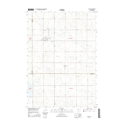
2015 Map of Bryant
USGS Topo · Published 2015About this map
Bryant serves as the primary settlement on this portion of the Coteau des Prairies, an expansive upland plateau that shapes the drainage patterns of eastern South Dakota. The town's grid is defined by streets such as Main St and Broadway St, reflecting the typical layout of a Midwestern railroad-influenced community. The surrounding landscape is characterized by numerous small depressions and water bodies, including Johnsons Slough and the headwaters of Dolph Cr, which meander through the prairie. For those researching local family history, several burial grounds are scattered across the township, including Woodlawn Cem just east of town, as well as Saint Marys Cem and Our Redeemer Cem. Farther south in Kingsbury County, the Clara Cem stands as a solitary landmark among the section lines of the agricultural grid.
Find a feature on this map
36 named features on this map. Tap any name to fly to it.
Don’t see what you’re looking for? This feature index may not catch every label — zoom into the map to look around manually.
Map Details
Editions of this 2015 Bryant Map
This is the sole edition of this map. No revisions or reprints were ever made.
Other maps of this area

1899 · De Smet
USGS Topo · 1:125,000

1953 · Watertown
USGS Topo · 1:250,000

1958 · Watertown
USGS Topo · 1:250,000

1968 · Lake Preston NE
USGS Topo · 1:24,000

1968 · Erwin
USGS Topo · 1:24,000

1971 · De Smet
USGS Topo · 1:24,000

1973 · Bryant NE
USGS Topo · 1:24,000

1973 · Bryant
USGS Topo · 1:24,000
1973 · Gertson Slough
USGS Topo · 1:24,000

1973 · Vienna West
USGS Topo · 1:24,000