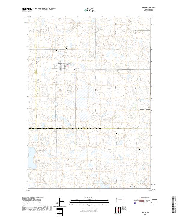
2021 Map of Bryant
USGS Topo · Published 2021About this map
Bryant occupies the heart of this East River landscape, positioned atop the distinctive Coteau des Prairies upland. The town's grid is anchored by E Main Ave and E 4th Ave, serving as a localized hub for the surrounding Hamlin County farmland. Genealogists will find a significant concentration of burial sites surrounding the community, including Saint Marys Cem, Our Redeemer Cem, and Woodlawn Cem. To the southeast, Clara Cem and Clara Lutheran Cem sit near the Kingsbury County line, reflecting the area's early Lutheran heritage. The terrain is defined by a glacial drainage pattern, with Dolph Creek meandering through the prairie toward Johnsons Slough, while Plum Lake marks the southwestern boundary. This 2021 survey illustrates the enduring agricultural and township structure of the region, where section lines and local roads like 193rd St organize the vast, open spaces of the coteau.
Find a feature on this map
30 named features on this map. Tap any name to fly to it.
Don’t see what you’re looking for? This feature index may not catch every label — zoom into the map to look around manually.
Map Details
Editions of this 2021 Bryant Map
This is the sole edition of this map. No revisions or reprints were ever made.
Other maps of this area

1899 · De Smet
USGS Topo · 1:125,000

1953 · Watertown
USGS Topo · 1:250,000

1958 · Watertown
USGS Topo · 1:250,000

1968 · Lake Preston NE
USGS Topo · 1:24,000

1968 · Erwin
USGS Topo · 1:24,000

1971 · De Smet
USGS Topo · 1:24,000

1973 · Bryant NE
USGS Topo · 1:24,000

1973 · Bryant
USGS Topo · 1:24,000
1973 · Gertson Slough
USGS Topo · 1:24,000

1973 · Vienna West
USGS Topo · 1:24,000