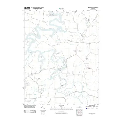
2010 Map of Bryantsville
USGS Topo · Published 2010About this map
The Dix River winds in deep meanders through this landscape, creating a series of dramatic peninsulas including Gwinn Island and Dunn Island. Along the high ground east of the river, the village of Bryantsville serves as a central point for local travel, situated near the intersection of Canoe Creek Rd and routes leading toward Marcellus. The map documents a rural patchwork of small settlements like Davistown, White Oak, and Little Needmore, many of which developed along the ridges overlooking the river valley.
Find a feature on this map
62 named features on this map. Tap any name to fly to it.
Don’t see what you’re looking for? This feature index may not catch every label — zoom into the map to look around manually.
Map Details
Editions of this 2010 Bryantsville Map
This is the sole edition of this map. No revisions or reprints were ever made.
Other maps of this area

1905 · Harrodsburg
USGS Topo · 1:125,000

1950 · Bryantsville
USGS Topo · 1:24,000

1952 · Little Hickman
USGS Topo · 1:24,000

1952 · Buckeye
USGS Topo · 1:24,000

1952 · Danville
USGS Topo · 1:24,000

1952 · Harrodsburg
USGS Topo · 1:24,000

1952 · Lancaster
USGS Topo · 1:24,000

1952 · Bryantsville
USGS Topo · 1:24,000

1952 · Stanford
USGS Topo · 1:24,000
1952 · Wilmore
USGS Topo · 1:24,000