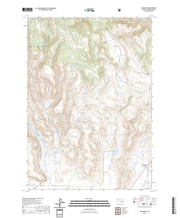
2023 Map of Buchanan
USGS Topo · Published 2023About this map
Malheur National Forest dominates the high desert terrain of eastern Oregon, where water management is the defining feature of the landscape. The small settlement of Buchanan sits near the junction of Crane-Buchanan Rd and Spring Creek, serving as a vital landmark in an area characterized by sophisticated water storage. A series of catchment systems, including the Upper Jones Canyon Reservoir and Lower Jones Canyon Reservoir, illustrate the historical reliance on seasonal runoff to support livestock and agriculture in the Cow Creek Valley. Family-named landmarks such as Poujade Field and Oard Flat suggest a long history of local ranching and land use. The topography is further defined by geologic features like the Gravel Ridges and numerous springs, including Rinfroe Springs and Demeris Spring, which provided essential water sources before the development of modern reservoirs.
Find a feature on this map
36 named features on this map. Tap any name to fly to it.
Don’t see what you’re looking for? This feature index may not catch every label — zoom into the map to look around manually.
Map Details
Editions of this 2023 Buchanan Map
This is the sole edition of this map. No revisions or reprints were ever made.
Other maps of this area

1955 · Burns
USGS Topo · 1:250,000

1958 · Burns
USGS Topo · 1:250,000

1959 · Burns
USGS Topo · 1:250,000

1959 · Harney
USGS Topo · 1:62,500

1961 · Calamity Butte
USGS Topo · 1:62,500

1968 · Van
USGS Topo · 1:62,500

1973 · Buchanan
USGS Topo · 1:24,000

1973 · Mahon Creek
USGS Topo · 1:24,000

1973 · Carson Point
USGS Topo · 1:24,000
1978 · Stinkingwater Pass
USGS Topo · 1:24,000