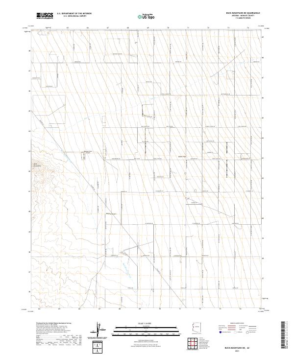
2021 Map of Buck Mountains NE
USGS Topo · Published 2021About this map
Buck Mountains dominate the western edge of this desert landscape, where the high terrain gives way to the broad alluvial expanse of Dutch Flat. This modern survey reveals a geometric grid of residential development names inspired by Western folklore, crisscrossing the Mojave Desert with thoroughfares like Butch Cassidy Rd, Lone Ranger Rd, and Sundance Kid Rd. The central role of aviation in this isolated region is highlighted by the Massey Farm Airport, situated near the foot of the mountains. Natural drainage is dictated by the Buck Mountain Wash and the ephemeral Cow Cr, which cut through the landscape toward Box Canyon. This map provides a clear picture of how 21st-century land subdivision has been superimposed onto the ancient, arid basins of Mohave County.
Find a feature on this map
65 named features on this map. Tap any name to fly to it.
Don’t see what you’re looking for? This feature index may not catch every label — zoom into the map to look around manually.
Map Details
Editions of this 2021 Buck Mountains NE Map
This is the sole edition of this map. No revisions or reprints were ever made.
Other maps of this area

1923 · Signal
USGS Topo · 1:250,000

1927 · Yucca
USGS Topo · 1:62,500

1927 · Buck Mountains
USGS Topo · 1:62,500

1929 · Buck Mountains
USGS Topo · 1:62,500

1929 · Yucca
USGS Topo · 1:62,500

1942 · Signal
USGS Topo · 1:250,000

1950 · Prescott
USGS Topo · 1:250,000

1954 · Needles
USGS Topo · 1:250,000

1954 · Prescott
USGS Topo · 1:250,000

1956 · Needles
USGS Topo · 1:250,000