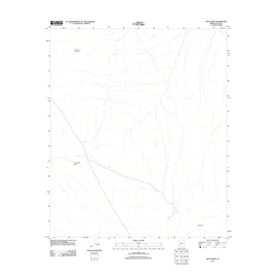
2011 Map of Buck Peak
USGS Topo · Published 2011About this map
The Copper Mountains rise in the northern portion of this Yuma County landscape, looking out over the arid expanses of the Lechuguilla Desert. This arid environment is defined by its stark relief and water scarcity, marked by vital catchments like Buck Peak Tank located near the southern topographic prominent point of Buck Peak. The network of seasonal washes and primitive tracks shown here reflects the enduring character of this borderlands region, where geography dictates movement and survival. This 2011 survey provides a contemporary perspective on the landforms of Southwest Arizona, detailing the intricate drainage patterns that carve through the desert floor.
Find a feature on this map
4 named features on this map. Tap any name to fly to it.
Don’t see what you’re looking for? This feature index may not catch every label — zoom into the map to look around manually.
Map Details
Editions of this 2011 Buck Peak Map
This is the sole edition of this map. No revisions or reprints were ever made.
Other maps of this area

1926 · Wellton
USGS Topo · 1:62,500

1926 · Mohawk
USGS Topo · 1:62,500

1928 · Mohawk
USGS Topo · 1:62,500

1929 · Wellton
USGS Topo · 1:62,500

1942 · Yuma
USGS Topo · 1:250,000

1953 · Ajo
USGS Topo · 1:250,000

1954 · El Centro
USGS Topo · 1:250,000

1955 · El Centro
USGS Topo · 1:250,000

1957 · Ajo
USGS Topo · 1:250,000

1958 · Ajo
USGS Topo · 1:250,000