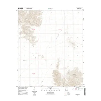
2014 Map of Buck Peak
USGS Topo · Published 2014About this map
The Copper Mountains dominate the northern landscape of this Yuma County survey, giving way to the wide expanse of the Lechuguilla Desert in the central portion of the quadrangle. This arid region of southwestern Arizona is defined by its dramatic relief and isolation, where the desert floor separates distinct mountain ranges. To the southeast, the Cabeza Prieta Mountains rise sharply, culminating at the summit of Buck Peak. Water resources are predictably scarce in this environment, with the Buck Peak Tank serving as one of the few named landmarks for navigation or wildlife in the vicinity of the peak. The map captures the rugged topography of the Sonoran Desert before any modern development, preserving the primitive character of the land as managed by the U.S. Department of the Interior.
Find a feature on this map
9 named features on this map. Tap any name to fly to it.
Don’t see what you’re looking for? This feature index may not catch every label — zoom into the map to look around manually.
Map Details
Editions of this 2014 Buck Peak Map
This is the sole edition of this map. No revisions or reprints were ever made.
Other maps of this area

1926 · Wellton
USGS Topo · 1:62,500

1926 · Mohawk
USGS Topo · 1:62,500

1928 · Mohawk
USGS Topo · 1:62,500

1929 · Wellton
USGS Topo · 1:62,500

1942 · Yuma
USGS Topo · 1:250,000

1953 · Ajo
USGS Topo · 1:250,000

1954 · El Centro
USGS Topo · 1:250,000

1955 · El Centro
USGS Topo · 1:250,000

1957 · Ajo
USGS Topo · 1:250,000

1958 · Ajo
USGS Topo · 1:250,000