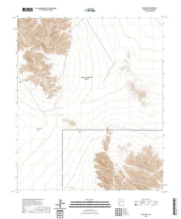
2021 Map of Buck Peak
USGS Topo · Published 2021About this map
Buck Peak rises as a prominent landmark in the southwestern corner of this survey, surrounded by the arid expanses of the Lechuguilla Desert. The landscape is dominated by significant relief, with the Copper Mountains in the northwest and the Cabeza Prieta Mountains defining the southeastern reaches. This territory represents a classic desert basin and range topography, where reliable water sources are rare. The inclusion of Buck Peak Tank indicates a critical point for land management and survival in an area otherwise characterized by vast stretches of open terrain and sparse infrastructure. The presence of these mountain ranges and the intervening desert flats illustrates the primary geographic constraints of this part of Yuma County, providing essential context for researchers studying the natural boundaries and land use of the region.
Find a feature on this map
9 named features on this map. Tap any name to fly to it.
Don’t see what you’re looking for? This feature index may not catch every label — zoom into the map to look around manually.
Map Details
Editions of this 2021 Buck Peak Map
This is the sole edition of this map. No revisions or reprints were ever made.
Other maps of this area

1926 · Wellton
USGS Topo · 1:62,500

1926 · Mohawk
USGS Topo · 1:62,500

1928 · Mohawk
USGS Topo · 1:62,500

1929 · Wellton
USGS Topo · 1:62,500

1942 · Yuma
USGS Topo · 1:250,000

1953 · Ajo
USGS Topo · 1:250,000

1954 · El Centro
USGS Topo · 1:250,000

1955 · El Centro
USGS Topo · 1:250,000

1957 · Ajo
USGS Topo · 1:250,000

1958 · Ajo
USGS Topo · 1:250,000