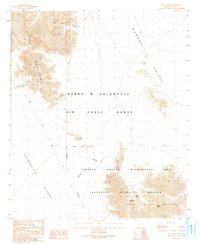
1990 Map of Buck Peak
USGS Topo · Published 1991About this map
McMillan Mine and scattered Mine Shafts indicate a history of mineral exploration in this arid stretch of Yuma County. This 1990 provisional map documents a complex landscape of military and environmental management, where the Barry M Goldwater Air Force Range meets the Cabeza Prieta Wilderness and National Wildlife Refuge. The terrain transitions from the Copper Mountains in the west to the Mohawk Valley in the northeast, characterized by numerous dry washes and isolated peaks like Buck Peak. The inclusion of the Buck Peak Tank underscores the critical importance of water management in the Lechuguilla Desert, serving both the natural wildlife and the human activities that have shaped this borderland region.
Find a feature on this map
12 named features on this map. Tap any name to fly to it.
Don’t see what you’re looking for? This feature index may not catch every label — zoom into the map to look around manually.
Map Details
Editions of this 1990 Buck Peak Map
This is the sole edition of this map. No revisions or reprints were ever made.
Other maps of this area

1926 · Wellton
USGS Topo · 1:62,500

1926 · Mohawk
USGS Topo · 1:62,500

1928 · Mohawk
USGS Topo · 1:62,500

1929 · Wellton
USGS Topo · 1:62,500

1942 · Yuma
USGS Topo · 1:250,000

1953 · Ajo
USGS Topo · 1:250,000

1954 · El Centro
USGS Topo · 1:250,000

1955 · El Centro
USGS Topo · 1:250,000

1957 · Ajo
USGS Topo · 1:250,000

1958 · Ajo
USGS Topo · 1:250,000