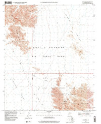
1996 Map of Buck Peak
USGS Topo · Published 2000About this map
The Copper Mountains dominate the northwestern corner of this landscape, giving way to the broad Mohawk Valley and the sprawling Lechuguilla Desert. This arid region in Yuma County serves as a critical junction for military and conservation land use in the late twentieth century. A significant portion of the terrain is occupied by the Barry M Goldwater Air Force Range, which transitions south into the Cabeza Prieta National Wildlife Refuge and the designated Cabeza Prieta Wilderness. Mineral exploration is evident near the Cabeza Prieta Mountains, where historical features like the McMillan Mine, various Mine Shafts, and a Prospect indicate past attempts to extract resources from this unforgiving environment. Water sources are scarce, represented only by isolated features like the Buck Peak Tank near the 2,522-foot summit of Buck Peak.
Find a feature on this map
17 named features on this map. Tap any name to fly to it.
Don’t see what you’re looking for? This feature index may not catch every label — zoom into the map to look around manually.
Map Details
Editions of this 1996 Buck Peak Map
This is the sole edition of this map. No revisions or reprints were ever made.
Other maps of this area

1926 · Wellton
USGS Topo · 1:62,500

1926 · Mohawk
USGS Topo · 1:62,500

1928 · Mohawk
USGS Topo · 1:62,500

1929 · Wellton
USGS Topo · 1:62,500

1942 · Yuma
USGS Topo · 1:250,000

1953 · Ajo
USGS Topo · 1:250,000

1954 · El Centro
USGS Topo · 1:250,000

1955 · El Centro
USGS Topo · 1:250,000

1957 · Ajo
USGS Topo · 1:250,000

1958 · Ajo
USGS Topo · 1:250,000