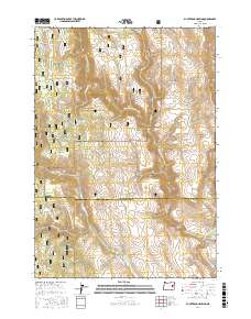
2017 Map of Buck Trough Spring
USGS Topo · Published 2017About this map
The Malheur National Forest provides the setting for this high-desert landscape in eastern Oregon, where water management is the primary driver of human modification. The terrain is defined by the headwaters and drainage basins of the North Fork Malheur River and the Little Malheur River, which have carved deep features such as Rattlesnake Canyon and Tin Wagon Canyon. To sustain livestock and wildlife in this arid environment, a series of man-made impoundments and spring developments are scattered across the quadrangle, including the Sixtynine Reservoir, Chalk Reservoir, and Skagway Reservoir. Higher elevations are marked by landmarks like Rattlesnake Ridge, while lower drainage areas include the winding Cottonwood Cr and Tamarack Cr, highlighting the vital nature of water sources like Buck Trough Spring and Mahogany Spring in the regional ecosystem.
Find a feature on this map
39 named features on this map. Tap any name to fly to it.
Don’t see what you’re looking for? This feature index may not catch every label — zoom into the map to look around manually.
Map Details
Editions of this 2017 Buck Trough Spring Map
This is the sole edition of this map. No revisions or reprints were ever made.
Other maps of this area

1908 · Ironside Mountain
USGS Topo · 1:125,000

1955 · Burns
USGS Topo · 1:250,000

1955 · Canyon City
USGS Topo · 1:250,000

1958 · Burns
USGS Topo · 1:250,000

1959 · Burns
USGS Topo · 1:250,000

1959 · Canyon City
USGS Topo · 1:250,000

1966 · Beulah
USGS Topo · 1:62,500

1968 · Drewsey
USGS Topo · 1:62,500

1970 · Flag Prairie
USGS Topo · 1:62,500

1970 · Castle Rock
USGS Topo · 1:62,500