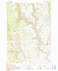
1990 Map of Buck Trough Spring
USGS Topo · Published 1991About this map
The North Fork Malheur River carves through the heart of the Malheur National Forest, defining the hydrological character of this high-elevation landscape. Water management for livestock or forestry is central to the area's development, evidenced by a network of small reservoirs such as Skagway Reservoir, Slate Reservoir, and 69 Reservoir. The terrain is deeply incised by drainages like Tin Wagon Canyon and Rattlesnake Canyon, which feed into the primary river systems.
Find a feature on this map
36 named features on this map. Tap any name to fly to it.
Don’t see what you’re looking for? This feature index may not catch every label — zoom into the map to look around manually.
Map Details
Editions of this 1990 Buck Trough Spring Map
This is the sole edition of this map. No revisions or reprints were ever made.
Other maps of this area

1908 · Ironside Mountain
USGS Topo · 1:125,000

1955 · Burns
USGS Topo · 1:250,000

1955 · Canyon City
USGS Topo · 1:250,000

1958 · Burns
USGS Topo · 1:250,000

1959 · Burns
USGS Topo · 1:250,000

1959 · Canyon City
USGS Topo · 1:250,000

1966 · Beulah
USGS Topo · 1:62,500

1968 · Drewsey
USGS Topo · 1:62,500

1970 · Flag Prairie
USGS Topo · 1:62,500

1970 · Castle Rock
USGS Topo · 1:62,500