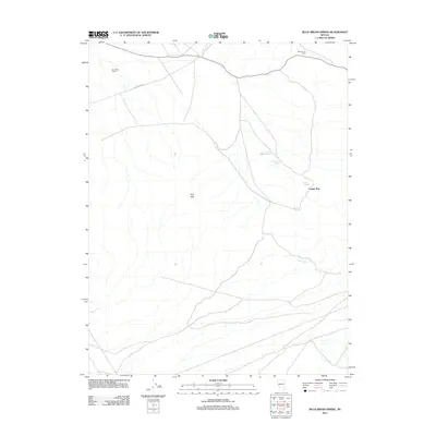
2011 Map of Buckbrush Spring
USGS Topo · Published 2011About this map
Buck Brush Spring and the surrounding high desert of Lyon County define this landscape at the start of the 21st century. The terrain is characterized by the Gray Hills and the seasonal drainage of Copper Run, illustrating a remote environment where water sources are the primary landmarks. Human presence is marked by infrastructure designed for land management and ranching, such as the Reese River Rd and expansive boundary lines like Four Mile Fence and Reese River Fence. Localized water infrastructure, including the Buck Brush Storage Tank and Water Tank Spring, indicates the essential nature of water management in this arid region. The map also identifies several other named water points, including Summit Spring and Abraham Spring, which serve as vital reference points for navigation and land use in this sparsely populated portion of Nevada.
Find a feature on this map
10 named features on this map. Tap any name to fly to it.
Don’t see what you’re looking for? This feature index may not catch every label — zoom into the map to look around manually.
Map Details
Editions of this 2011 Buckbrush Spring Map
This is the sole edition of this map. No revisions or reprints were ever made.
Other maps of this area

1891 · Wellington
USGS Topo · 1:125,000

1893 · Wellington
USGS Topo · 1:125,000

1909 · Hawthorne
USGS Topo · 1:250,000

1911 · Hawthorne
USGS Topo · 1:250,000

1915 · Hawthorne
USGS Topo · 1:250,000

1948 · Walker Lake
USGS Topo · 1:250,000

1956 · Mt. Grant
USGS Topo · 1:62,500

1957 · Walker Lake
USGS Topo · 1:250,000

1957 · Yerington
USGS Topo · 1:62,500

1958 · Pine Grove Hills
USGS Topo · 1:62,500