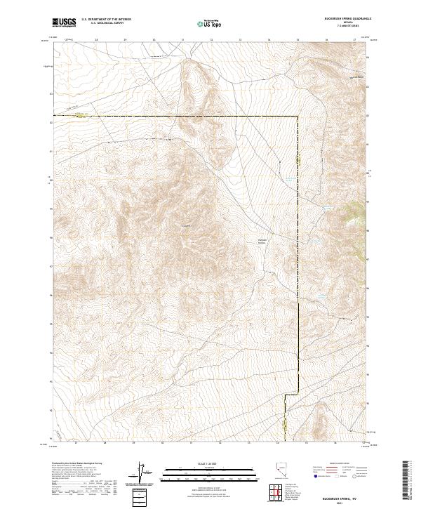
2021 Map of Buckbrush Spring
USGS Topo · Published 2021About this map
The Wassuk Range and the rolling terrain of the Gray Hills dominate this high-desert landscape along the border of Lyon and Mineral Counties. This 2021 update records the sparse but vital water sources that have historically defined movement through these arid corridors, including Buck Brush Spring and the nearby Summit Spring to the east. The land is characterized by steep elevation shifts and natural depressions like Pumpkin Hollow, providing a clear view of the Basin and Range topography. Modern access is preserved through regional routes such as Reese River Rd in the north and E Walker Rd at the southern edge, illustrating how early pioneer trails often dictated the paths of contemporary local roads. The map serves as a detailed guide to the hydrological features like Abraham Spring that remain the primary landmarks in this unpopulated stretch of Nevada.
Find a feature on this map
17 named features on this map. Tap any name to fly to it.
Don’t see what you’re looking for? This feature index may not catch every label — zoom into the map to look around manually.
Map Details
Editions of this 2021 Buckbrush Spring Map
This is the sole edition of this map. No revisions or reprints were ever made.
Other maps of this area

1891 · Wellington
USGS Topo · 1:125,000

1893 · Wellington
USGS Topo · 1:125,000

1909 · Hawthorne
USGS Topo · 1:250,000

1911 · Hawthorne
USGS Topo · 1:250,000

1915 · Hawthorne
USGS Topo · 1:250,000

1948 · Walker Lake
USGS Topo · 1:250,000

1956 · Mt. Grant
USGS Topo · 1:62,500

1957 · Walker Lake
USGS Topo · 1:250,000

1957 · Yerington
USGS Topo · 1:62,500

1958 · Pine Grove Hills
USGS Topo · 1:62,500