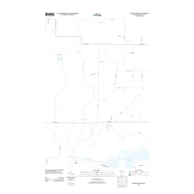
2013 Map of Buckety Creek
USGS Topo · Published 2013About this map
Saint Croix River and its expansive Saint Croix Flowage dominate the southern portion of this landscape, where the Gordon Flowage Campground and Bubar Island mark the primary recreational and geographic hubs. The northern terrain is defined by the winding course of the Moose River, which feeds into the Moose Branch Flowage near Jackson Box Rd.
Find a feature on this map
36 named features on this map. Tap any name to fly to it.
Don’t see what you’re looking for? This feature index may not catch every label — zoom into the map to look around manually.
Map Details
Editions of this 2013 Buckety Creek Map
This is the sole edition of this map. No revisions or reprints were ever made.
Other maps of this area

1945 · Solon Springs
USGS Topo · 1:48,000

1947 · Minong
USGS Topo · 1:48,000

1949 · Solon Springs
USGS Topo · 1:48,000

1949 · Minong
USGS Topo · 1:48,000

1949 · Webb Lake
USGS Topo · 1:48,000

1949 · Patzau
USGS Topo · 1:48,000

1953 · Ashland
USGS Topo · 1:250,000

1953 · Duluth
USGS Topo · 1:250,000

1954 · Amnicon Lake
USGS Topo · 1:24,000
1954 · Lyman Lake
USGS Topo · 1:24,000