
1979 Map of Buckeye East
USGS Topo · Published 1980About this map
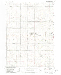
Buckeye sits at the edge of this prairie landscape, where the agricultural grid is defined by the winding course of the South Fork Iowa River and its tributaries. The late 1970s character of the area is visible through the infrastructure of rural Hardin County, including the Iowa Falls Municipal Airport and a Drive-in Theater near the northern boundary. Settlement patterns are anchored by historic meeting places and burial grounds such as Cottage Ch, Ellis Ch, and several well-maintained cemeteries including Lincoln Cem and Tipton Cem. The land use shows a mix of recreation and industry, with the Izaak Walton County Park providing public space near active Quarry and Gravel Pit operations. Transportation is dominated by the intersecting routes of the Chicago and North Western and Chicago Rock Island and Pacific railroads, which once facilitated the movement of grain and goods across these townships.
Find a feature on this map
24 named features on this map. Tap any name to fly to it.
Don’t see what you’re looking for? This feature index may not catch every label — zoom into the map to look around manually.
Map Details
Editions of this 1979 Buckeye East Map
This is the sole edition of this map. No revisions or reprints were ever made.
Other maps of this area

1954 · Waterloo
USGS Topo · 1:250,000

1955 · Waterloo
USGS Topo · 1:250,000

1979 · Iowa Falls West
USGS Topo · 1:24,000

1979 · Buckeye West
USGS Topo · 1:24,000

1979 · Popejoy
USGS Topo · 1:24,000

1979 · New Providence
USGS Topo · 1:24,000

1979 · Iowa Falls East
USGS Topo · 1:24,000

1979 · Hubbard
USGS Topo · 1:24,000
1979 · Radcliffe
USGS Topo · 1:24,000
1979 · Owasa
USGS Topo · 1:24,000