
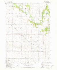
1979 Map of New Providence
USGS Topo · Published 1980About this map
The South Fork Iowa River winds through the northern half of this Hardin County landscape, where the agricultural township of Providence centers on the community of New Providence. The map illustrates a social infrastructure built around education and community, notably featuring the State Training School for Boys and the Quakerdale Sch. A network of small country cemeteries, including Rough Woods Cem and Highland Cem, provides a detailed record for genealogists tracking early families near the river's edge.
Find a feature on this map
28 named features on this map. Tap any name to fly to it.
Don’t see what you’re looking for? This feature index may not catch every label — zoom into the map to look around manually.
Map Details
Editions of this 1979 New Providence Map
This is the sole edition of this map. No revisions or reprints were ever made.
Other maps of this area

1954 · Waterloo
USGS Topo · 1:250,000

1955 · Waterloo
USGS Topo · 1:250,000

1975 · State Center NW
USGS Topo · 1:24,000

1975 · Union
USGS Topo · 1:24,000

1975 · Zearing
USGS Topo · 1:24,000

1979 · Buckeye East
USGS Topo · 1:24,000

1979 · Steamboat Rock
USGS Topo · 1:24,000

1979 · Hubbard
USGS Topo · 1:24,000

1979 · Eldora
USGS Topo · 1:24,000
1979 · Owasa
USGS Topo · 1:24,000