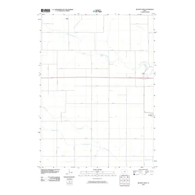
2010 Map of Buckeye West
USGS Topo · Published 2010About this map
Buckeye and Wilke anchor this agricultural landscape in Hardin County during the early 21st century. The terrain is defined by a sophisticated water management system necessary for Iowa's intensive prairie farming, featuring the channelized Big 4 Drainage Ditch and the naturally meandering South Fork Iowa River. These watercourses, along with Tipton Creek and New York Branch, cut through a rigid section-line grid of rural roads like Hwy D25 and Co Hwy S27. The layout of the small settlements and the placement of the Buckeye Cemetery reflect a century of rural development, where the infrastructure of drainage and transport transformed the wet prairie into productive cropland. This survey provides a precise look at the modern rural interface, where traditional farmsteads meet engineered waterways and local county thoroughfares.
Find a feature on this map
33 named features on this map. Tap any name to fly to it.
Don’t see what you’re looking for? This feature index may not catch every label — zoom into the map to look around manually.
Map Details
Editions of this 2010 Buckeye West Map
This is the sole edition of this map. No revisions or reprints were ever made.
Other maps of this area

1954 · Waterloo
USGS Topo · 1:250,000

1955 · Waterloo
USGS Topo · 1:250,000

1978 · Ellsworth
USGS Topo · 1:24,000

1978 · Sheldon Creek
USGS Topo · 1:24,000

1978 · Williams
USGS Topo · 1:24,000

1979 · Iowa Falls West
USGS Topo · 1:24,000

1979 · Buckeye West
USGS Topo · 1:24,000

1979 · Buckeye East
USGS Topo · 1:24,000

1979 · Popejoy
USGS Topo · 1:24,000

1979 · Hubbard
USGS Topo · 1:24,000