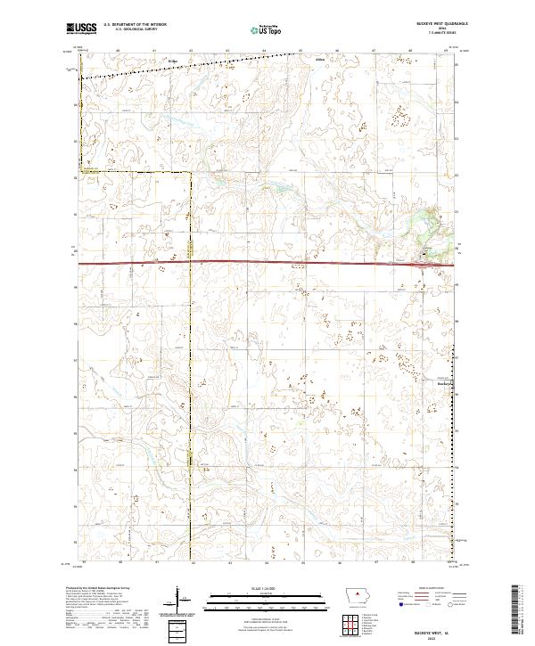
2022 Map of Buckeye West
USGS Topo · Published 2022About this map
Buckeye and Wilke anchor this agricultural landscape along the western edge of Hardin County, where the prairie has been systematically organized into the characteristic square-mile sections of the Public Land Survey System. The S Fork Iowa River meanders across the northern half of the sheet, contrasted by the engineered precision of the Big 4 Drainage Ditch, a testament to the region's long history of land reclamation for farming. In the northeastern corner, a portion of Alden appears just above the river valley. The southern portion of the map is defined by the winding course of Tipton Cr and its tributary, New York Br. Local history is centered at the Buckeye Cem, located just north of the main settlement near the junction of Co Rd S27 and 175th St. This survey captures the enduring rural infrastructure of the Iowa heartland, from named farm-to-market roads like Ziegler Ave to the vital water management systems that support the surrounding fields.
Find a feature on this map
48 named features on this map. Tap any name to fly to it.
Don’t see what you’re looking for? This feature index may not catch every label — zoom into the map to look around manually.
Map Details
Editions of this 2022 Buckeye West Map
This is the sole edition of this map. No revisions or reprints were ever made.
Other maps of this area

1954 · Waterloo
USGS Topo · 1:250,000

1955 · Waterloo
USGS Topo · 1:250,000

1978 · Ellsworth
USGS Topo · 1:24,000

1978 · Sheldon Creek
USGS Topo · 1:24,000

1978 · Williams
USGS Topo · 1:24,000

1979 · Iowa Falls West
USGS Topo · 1:24,000

1979 · Buckeye West
USGS Topo · 1:24,000

1979 · Buckeye East
USGS Topo · 1:24,000

1979 · Popejoy
USGS Topo · 1:24,000

1979 · Hubbard
USGS Topo · 1:24,000