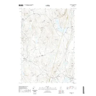
2021 Map of Buckfield
USGS Topo · Published 2021About this map
Buckfield and the surrounding highlands of Oxford and Androscoggin counties define this landscape of interconnected water bodies and early Yankee settlements. The Nezinscot River and its East Branch wind through valleys flanked by numerous family-named landmarks, such as Deacon Pinnacle and Hayford Hill. Local history is deeply etched into the hillsides via a network of historic burial grounds, including Meeting House Hill Cem and the Harlow Family Cem near Bear Pond.
Find a feature on this map
128 named features on this map. Tap any name to fly to it.
Don’t see what you’re looking for? This feature index may not catch every label — zoom into the map to look around manually.
Map Details
Editions of this 2021 Buckfield Map
This is the sole edition of this map. No revisions or reprints were ever made.
Other maps of this area

1908 · Poland
USGS Topo · 1:62,500

1908 · Lewiston
USGS Topo · 1:62,500

1910 · Livermore
USGS Topo · 1:62,500

1911 · Buckfield
USGS Topo · 1:62,500

1912 · Livermore
USGS Topo · 1:62,500

1913 · Buckfield
USGS Topo · 1:62,500

1940 · Poland
USGS Topo · 1:62,500

1941 · Livermore
USGS Topo · 1:62,500

1942 · Lewiston
USGS Topo · 1:62,500

1942 · Buckfield
USGS Topo · 1:62,500