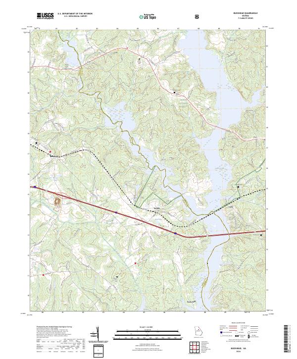
2024 Map of Buckhead
USGS Topo · Published 2024About this map
Lake Oconee dominates the eastern landscape of this modern survey, marking the flooded valley where the Morgan and Greene county line follows the submerged river channel. The map illustrates a complex geography of water and woodland, including significant acreage within the Oconee National Forest. Small settlements like Swords, Carey, and Buckhead are connected by a network of rural roads and rail infrastructure, with several family and community cemeteries such as Fork Chapel Cem and Mount Zion Cem providing critical points of reference for genealogists. The topography is defined by the drainages of Sugar Creek and Goose Creek, which feed into the primary reservoir. This contemporary representation documents how modern infrastructure, such as the rail corridor passing through Buckhead, interacts with the established natural boundaries of middle Georgia.
Find a feature on this map
86 named features on this map. Tap any name to fly to it.
Don’t see what you’re looking for? This feature index may not catch every label — zoom into the map to look around manually.
Map Details
Editions of this 2024 Buckhead Map
This is the sole edition of this map. No revisions or reprints were ever made.
Other maps of this area

1953 · Athens
USGS Topo · 1:250,000

1958 · Athens
USGS Topo · 1:250,000

1959 · Athens
USGS Topo · 1:250,000

1963 · Athens
USGS Topo · 1:250,000

1972 · Penfield
USGS Topo · 1:24,000

1972 · Liberty
USGS Topo · 1:24,000

1972 · Buckhead
USGS Topo · 1:24,000

1972 · Apalachee
USGS Topo · 1:24,000

1972 · Harmony
USGS Topo · 1:24,000

1972 · Rock Eagle Lake
USGS Topo · 1:24,000