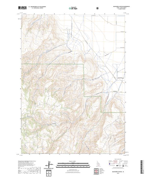
2024 Map of Buckhorn Canyon
USGS Topo · Published 2024About this map
Sawtooth National Forest dominates this high-altitude landscape in Cassia County, where the terrain is defined by deep drainage networks and high ridgelines like Cottonwood Ridge. This modern survey illustrates the rugged interface between protected forest lands and ranching history, noting specific locations like Garrard Ranch and Iversons on the eastern edge. A complex system of canyons, including Buckhorn Canyon and Big Cedar Canyon, directs the flow of seasonal and perennial waters such as Mountain Meadow Creek and Big Cottonwood Creek. Vital water sources for livestock and wildlife are marked throughout the hills, including Whiskey Spring, Buckhorn Spring, and Tub Spring. The network of backroads and paths like the Big Cottonwood Trl and Cave Canyon Trl provides a detailed look at how this part of Idaho remains accessible for recreation and land management today.
Find a feature on this map
34 named features on this map. Tap any name to fly to it.
Don’t see what you’re looking for? This feature index may not catch every label — zoom into the map to look around manually.
Map Details
Editions of this 2024 Buckhorn Canyon Map
This is the sole edition of this map. No revisions or reprints were ever made.
Other maps of this area

1954 · Pocatello
USGS Topo · 1:250,000

1955 · Twin Falls
USGS Topo · 1:250,000

1958 · Twin Falls
USGS Topo · 1:250,000

1958 · Pocatello
USGS Topo · 1:250,000

1964 · Burley Butte
USGS Topo · 1:24,000

1965 · Rams Horn Ridge
USGS Topo · 1:24,000

1965 · Milner Butte
USGS Topo · 1:24,000

1965 · Murtaugh
USGS Topo · 1:24,000

1965 · Buckhorn Canyon
USGS Topo · 1:24,000
1968 · Oakley
USGS Topo · 1:24,000