
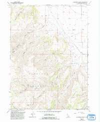
1965 Map of Buckhorn Canyon
USGS Topo · Published 1967About this map
Sawtooth National Forest dominates the southern half of this Idaho landscape, where high ridges and deep drainages define the transition from canyon floor to timbered uplands. The mapping reveals a ranching economy concentrated along the northern flats and canyon mouths, anchored by Buckhorn Ranch, Warm Creek Ranch, and Garrard Ranch. These homesteads and the nearby Iversons settlement relied on scattered water sources like Whiskey Spring and Buckhorn Spring to sustain life in this arid environment.
Find a feature on this map
23 named features on this map. Tap any name to fly to it.
Don’t see what you’re looking for? This feature index may not catch every label — zoom into the map to look around manually.
Map Details
Editions of this 1965 Buckhorn Canyon Map
2 editions found
Other maps of this area

1954 · Pocatello
USGS Topo · 1:250,000

1955 · Twin Falls
USGS Topo · 1:250,000

1958 · Twin Falls
USGS Topo · 1:250,000

1958 · Pocatello
USGS Topo · 1:250,000

1964 · Burley Butte
USGS Topo · 1:24,000

1965 · Rams Horn Ridge
USGS Topo · 1:24,000

1965 · Milner Butte
USGS Topo · 1:24,000

1965 · Murtaugh
USGS Topo · 1:24,000
1968 · Oakley
USGS Topo · 1:24,000
1968 · Marion
USGS Topo · 1:24,000