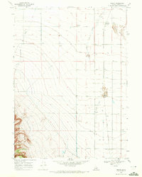
1968 Map of Marion
USGS Topo · Published 1972About this map
Goose Creek defines the lower drainage of this Idaho landscape, where irrigated agriculture and rail transport meet in the late 1960s. The Union Pacific railroad line is the spine of the local economy, connecting grain handling facilities like the Grain Elevator at Churchill (Siding) with smaller outposts like Warr and Locust. Evidence of the transition from early settlement to modern infrastructure is visible at Churchill (Siding), indicating a shift in the community's center of gravity toward the rail siding.
Find a feature on this map
30 named features on this map. Tap any name to fly to it.
Don’t see what you’re looking for? This feature index may not catch every label — zoom into the map to look around manually.
Map Details
Editions of this 1968 Marion Map
This is the sole edition of this map. No revisions or reprints were ever made.
Other maps of this area

1954 · Pocatello
USGS Topo · 1:250,000

1955 · Twin Falls
USGS Topo · 1:250,000

1958 · Twin Falls
USGS Topo · 1:250,000

1958 · Pocatello
USGS Topo · 1:250,000

1964 · Kenyon
USGS Topo · 1:24,000

1964 · Burley Butte
USGS Topo · 1:24,000

1965 · Milner Butte
USGS Topo · 1:24,000

1965 · Buckhorn Canyon
USGS Topo · 1:24,000

1968 · Basin
USGS Topo · 1:24,000

1968 · Marion SE
USGS Topo · 1:24,000