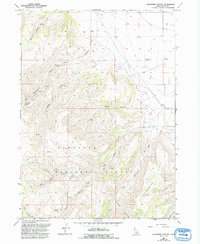
1965 Map of Buckhorn Canyon
USGS Topo · Published 1992About this map
The Sawtooth National Forest dominates this section of Cassia County, where the high-elevation landscape is defined by a series of dramatic canyons and ridges. Settlers and ranchers established footholds at the Buckhorn Ranch and Warm Creek Ranch, while the inclusion of the Buckhorn Substation and an Aqueduct indicates the mid-20th-century development of water and power infrastructure. Local history and genealogy interest is anchored by a lone Cem and isolated landmarks like Franks, alongside several springs such as Whiskey Spring and Tub Spring. The map documents a transition from the wilder terrain of Robber Gulch and Little Canyon to the more managed plains marked by Gravel Pits and a network of Ditch lines. Transportation in the higher reaches remains limited to a Pack Trail and 4WD tracks, emphasizing the area's isolation during the 1960s.
Find a feature on this map
36 named features on this map. Tap any name to fly to it.
Don’t see what you’re looking for? This feature index may not catch every label — zoom into the map to look around manually.
Map Details
Editions of this 1965 Buckhorn Canyon Map
2 editions found
Other maps of this area

1954 · Pocatello
USGS Topo · 1:250,000

1955 · Twin Falls
USGS Topo · 1:250,000

1958 · Twin Falls
USGS Topo · 1:250,000

1958 · Pocatello
USGS Topo · 1:250,000

1964 · Burley Butte
USGS Topo · 1:24,000

1965 · Rams Horn Ridge
USGS Topo · 1:24,000

1965 · Milner Butte
USGS Topo · 1:24,000

1965 · Murtaugh
USGS Topo · 1:24,000

1965 · Buckhorn Canyon
USGS Topo · 1:24,000
1968 · Oakley
USGS Topo · 1:24,000