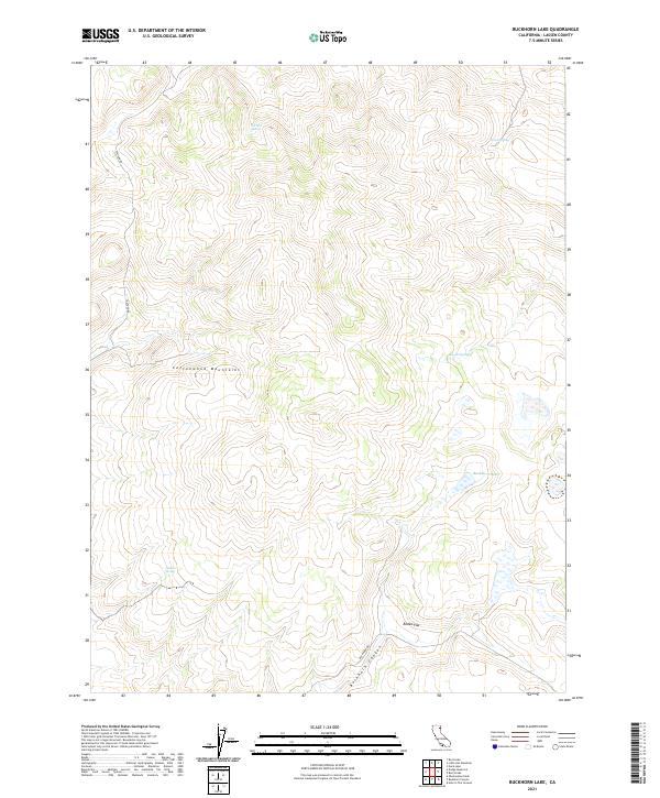
2021 Map of Buckhorn Lake
USGS Topo · Published 2021About this map
The Cottonwood Mountains dominate this high-desert landscape in Lassen County, defined by a series of isolated water sources essential for survival in the arid Great Basin. The map centers on Buckhorn Lake, a seasonal water body that transitions into the wide drainage of Buckhorn Canyon to the south. This area is characterized by its reliance on natural springs, including Gerlach Spring, Gallion Spring, Brine Spring, and Bryant Spring, which historically supported livestock and travelers. Local transit is limited to unpaved routes like Tuledad Rd and Buckhorn Rd, which cross open terrain such as Rodeo Flat. The layout reflects the traditional township and range grid, illustrating the remote and largely uninhabited character of this northeastern California region in the early 21st century.
Find a feature on this map
14 named features on this map. Tap any name to fly to it.
Don’t see what you’re looking for? This feature index may not catch every label — zoom into the map to look around manually.
Map Details
Editions of this 2021 Buckhorn Lake Map
This is the sole edition of this map. No revisions or reprints were ever made.
Other maps of this area

1886 · Alturas
USGS Topo · 1:250,000

1886 · Honey Lake
USGS Topo · 1:250,000

1886 · Granite Range
USGS Topo · 1:250,000

1889 · Long Valley
USGS Topo · 1:250,000

1891 · Honey Lake
USGS Topo · 1:250,000

1892 · Alturas
USGS Topo · 1:250,000

1893 · Honey Lake
USGS Topo · 1:250,000

1894 · Granite Range
USGS Topo · 1:250,000

1954 · Observation Peak
USGS Topo · 1:62,500

1954 · Vya
USGS Topo · 1:250,000