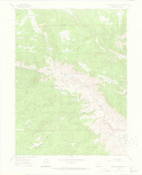
1962 Map of Buckhorn Mountain
USGS Topo · Published 1969About this map
Roosevelt National Forest dominates this mountain landscape, defined by a series of prominent ridges and named gulches that reveal the early 1960s character of Larimer County. The map documents a rugged interior geography where Flowers Road and various trails provide the primary access through high-elevation terrain. Settlement is sparse, anchored by Stove Prairie and the Buckhorn Lodge, suggesting a landscape of seasonal recreation and isolated homesteads.
Find a feature on this map
40 named features on this map. Tap any name to fly to it.
Don’t see what you’re looking for? This feature index may not catch every label — zoom into the map to look around manually.
Map Details
Editions of this 1962 Buckhorn Mountain Map
4 editions found
Other maps of this area

1905 · Mount Olympus
USGS Topo · 1:62,500

1906 · Loveland
USGS Topo · 1:62,500

1906 · Fort Collins
USGS Topo · 1:62,500

1907 · Mount Olympus
USGS Topo · 1:62,500

1907 · Livermore
USGS Topo · 1:125,000

1908 · Loveland
USGS Topo · 1:62,500

1908 · Fort Collins
USGS Topo · 1:62,500

1909 · Livermore
USGS Topo · 1:125,000

1954 · Greeley
USGS Topo · 1:250,000

1957 · Greeley
USGS Topo · 1:250,000