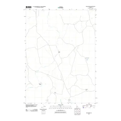
2010 Map of Buckhorn
USGS Topo · Published 2010About this map
Marys Creek and its various tributaries define this section of Owyhee County, where the landscape is marked more by water sources and cattle infrastructure than by formal townships. The presence of Buckhorn Corrals and the namesake Buckhorn locality suggests a focus on ranching operations within the wider Antelope Basin. Small, isolated family-named landmarks such as Frost Place and Dickens Place indicate the historical footprint of early homesteading or seasonal ranching outposts in this arid region.
Find a feature on this map
10 named features on this map. Tap any name to fly to it.
Don’t see what you’re looking for? This feature index may not catch every label — zoom into the map to look around manually.
Map Details
Editions of this 2010 Buckhorn Map
This is the sole edition of this map. No revisions or reprints were ever made.
Other maps of this area

1955 · Jordan Valley
USGS Topo · 1:250,000

1955 · Twin Falls
USGS Topo · 1:250,000

1957 · Jordan Valley
USGS Topo · 1:250,000

1958 · Twin Falls
USGS Topo · 1:250,000

1958 · Jordan Valley
USGS Topo · 1:250,000
1971 · Three Forks
USGS Topo · 1:24,000
1971 · Riddle
USGS Topo · 1:24,000
1972 · Little Blue Table
USGS Topo · 1:24,000
1979 · Antelope Creek
USGS Topo · 1:24,000
1979 · Indian Hay Meadows
USGS Topo · 1:24,000