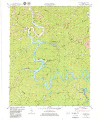
1979 Map of Buckhorn
USGS Topo · Published 1979About this map
Middle Fork Kentucky River defines this landscape, where the construction of the Buckhorn Dam has transformed the valley into the sprawling Buckhorn Lake. The 1970s terrain reveals a community balanced between traditional mountain life and a growing recreational economy, anchored by Buckhorn Lake State Resort Park. Small settlements like Buckhorn and Bowlington sit near the water’s edge, while numerous extractive sites, including a Strip Mine and various Mines, dot the surrounding ridges. Genealogists will find significant local value in the documented family and community landmarks, such as the Deaton Cem, Johnson Ch, and the Leatherwood Sch. This survey captures the region as it transitioned from a remote river valley into a structured water-management and park system, preserving the locations of earlier homesteads and church sites like Johnson Cem before further modernization changed the landscape.
Find a feature on this map
90 named features on this map. Tap any name to fly to it.
Don’t see what you’re looking for? This feature index may not catch every label — zoom into the map to look around manually.
Map Details
Editions of this 1979 Buckhorn Map
This is the sole edition of this map. No revisions or reprints were ever made.
Other maps of this area

1891 · Manchester
USGS Topo · 1:125,000

1891 · Hazard
USGS Topo · 1:125,000

1913 · Buckhorn
USGS Topo · 1:62,500

1916 · Hyden
USGS Topo · 1:48,000

1919 · Hyden
USGS Topo · 1:62,500

1953 · Buckhorn
USGS Topo · 1:24,000

1953 · Cowcreek
USGS Topo · 1:24,000

1953 · Hyden West
USGS Topo · 1:24,000

1953 · Big Creek
USGS Topo · 1:24,000

1953 · Mistletoe
USGS Topo · 1:24,000