
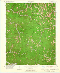
1953 Map of Mistletoe
USGS Topo · Published 1955About this map
Sebastian and Dalesburg anchor this 1950s study of the eastern Kentucky hills, where the landscape is defined by an intricate network of narrow hollows and steep ridges. The drainage patterns of Bullskin Creek and Big Twin Creek dictated the placement of small communities and the winding roads that connect them. This era reveals a decentralized social structure, with numerous local institutions like Highland Sch and Rockhouse Sch serving isolated rural neighborhoods.
Find a feature on this map
131 named features on this map. Tap any name to fly to it.
Don’t see what you’re looking for? This feature index may not catch every label — zoom into the map to look around manually.
Map Details
Editions of this 1953 Mistletoe Map
2 editions found
Other maps of this area

1891 · Manchester
USGS Topo · 1:125,000

1891 · Hazard
USGS Topo · 1:125,000

1913 · Buckhorn
USGS Topo · 1:62,500

1916 · Hyden
USGS Topo · 1:48,000

1919 · Hyden
USGS Topo · 1:62,500

1953 · Buckhorn
USGS Topo · 1:24,000

1953 · Oneida
USGS Topo · 1:24,000

1953 · Cowcreek
USGS Topo · 1:24,000

1953 · Hyden West
USGS Topo · 1:24,000

1953 · Big Creek
USGS Topo · 1:24,000