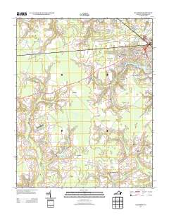
2013 Map of Buckhorn
USGS Topo · Published 2013About this map
Low-lying wetlands and scattered settlements define this section of the Virginia Coastal Plain south of Suffolk. The landscape is dominated by the sprawling headwaters of Jones Swamp and Council Swamp, where the slow-moving drainage patterns have shaped local land use for generations. Small communities like Lummis and Box Elder are situated along the secondary road network, while the northeastern corner shows a denser residential progression with neighborhoods such as Barrett Acres, Pinaire, and Bethlehem Terrace bordering the city's outskirts. Water management and recreational assets are prominent, including the Speights Run Reservoir and the residential area of Lake Speight Colony. For researchers interested in regional aviation or infrastructure, the Grasso Salvage Airport represents a specific landmark of interest, alongside several named crossings such as Bakers Crossing.
Find a feature on this map
73 named features on this map. Tap any name to fly to it.
Don’t see what you’re looking for? This feature index may not catch every label — zoom into the map to look around manually.
Map Details
Editions of this 2013 Buckhorn Map
This is the sole edition of this map. No revisions or reprints were ever made.
Other maps of this area

1919 · Smithfield
USGS Topo · 1:62,500

1919 · Suffolk
USGS Topo · 1:62,500

1920 · Holland
USGS Topo · 1:62,500

1920 · Ivor
USGS Topo · 1:62,500

1943 · Holland
USGS Topo · 1:62,500

1944 · Windsor
USGS Topo · 1:31,680

1944 · Zuni
USGS Topo · 1:24,000

1945 · Zuni
USGS Topo · 1:31,680

1949 · Chuckatuck
USGS Topo · 1:24,000

1953 · Norfolk
USGS Topo · 1:250,000