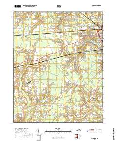
2019 Map of Buckhorn
USGS Topo · Published 2019About this map
Speights Run and several significant wetland systems define the landscape south of Suffolk in this detailed 2019 survey. The area is characterized by a patchwork of wooded swamplands, including the Daughtrey Pocosin, Quaker Swamp, and Jones Swamp. Small settlements and historic family hubs such as Lummis, Kenyon, and Nurneysville are connected by a network of rural roads that cross these low-lying drainages. In the northeast, the expansion of the Suffolk city area is evident near the Paul D Camp Community College - Hobbs Suffolk Campus. The map also documents several local burial grounds, including Rawles Cem and Barrett Cem, which serve as vital markers for genealogists tracing regional family history. Infrastructure like the Grasso Salvage Airport and major thoroughfares such as Holland Rd illustrate the modern transit and industry overlaying this ancient coastal plain drainage system.
Find a feature on this map
72 named features on this map. Tap any name to fly to it.
Don’t see what you’re looking for? This feature index may not catch every label — zoom into the map to look around manually.
Map Details
Editions of this 2019 Buckhorn Map
This is the sole edition of this map. No revisions or reprints were ever made.
Other maps of this area

1919 · Smithfield
USGS Topo · 1:62,500

1919 · Suffolk
USGS Topo · 1:62,500

1920 · Holland
USGS Topo · 1:62,500

1920 · Ivor
USGS Topo · 1:62,500

1943 · Holland
USGS Topo · 1:62,500

1944 · Windsor
USGS Topo · 1:31,680

1944 · Zuni
USGS Topo · 1:24,000

1945 · Zuni
USGS Topo · 1:31,680

1949 · Chuckatuck
USGS Topo · 1:24,000

1953 · Norfolk
USGS Topo · 1:250,000