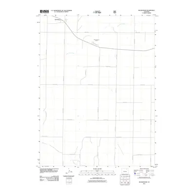
2011 Map of Buckingham
USGS Topo · Published 2011About this map
The settlement of Buckingham sits at the northern edge of this high plains landscape, situated along the intersection of local routes including County Rd 115. The area is characterized by a sprawling grid of rural infrastructure, where long stretches of road like County Rd 86 and County Rd 123 connect isolated ranching sites and aviation markers. The Williams Ranch Airport serves as a distinct landmark in this vast open country, reflecting the logistical needs of modern high-plains operations.
Find a feature on this map
24 named features on this map. Tap any name to fly to it.
Don’t see what you’re looking for? This feature index may not catch every label — zoom into the map to look around manually.
Map Details
Editions of this 2011 Buckingham Map
This is the sole edition of this map. No revisions or reprints were ever made.
Other maps of this area

1951 · Sunken Lake
USGS Topo · 1:24,000

1951 · Peace Valley School
USGS Topo · 1:24,000

1951 · Judson Hills
USGS Topo · 1:24,000

1954 · Sterling
USGS Topo · 1:250,000

1954 · Greeley
USGS Topo · 1:250,000

1957 · Greeley
USGS Topo · 1:250,000

1958 · Greeley
USGS Topo · 1:250,000

1958 · Sterling
USGS Topo · 1:250,000

1961 · Greeley
USGS Topo · 1:250,000

1964 · Greeley
USGS Topo · 1:250,000