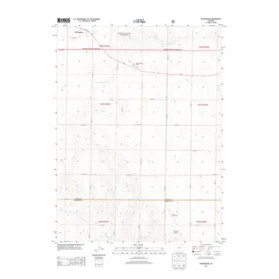
2013 Map of Buckingham
USGS Topo · Published 2013About this map
Buckingham marks the primary settlement in this high plains landscape, situated near the intersection of State Hwy 14 and several county roads. The northern portion of the region is defined by the Pawnee National Grassland, where the terrain is scored by the drainage of South Pawnee Creek. To the south, the landscape transitions across the boundary between Weld and Morgan counties, featuring more varied relief near Sterling Canyon and the headwaters of Wildcat Creek. This 2013 survey illustrates a modern rural infrastructure of section-line roads, such as CO Road 80 and CO Road 121, which support isolated aviation facilities like Williams Ranch Airport and Wirth Field Airport. The map provides a clear record of the rectilinear land divisions and drainage patterns that characterize this portion of the Colorado plains.
Find a feature on this map
36 named features on this map. Tap any name to fly to it.
Don’t see what you’re looking for? This feature index may not catch every label — zoom into the map to look around manually.
Map Details
Editions of this 2013 Buckingham Map
This is the sole edition of this map. No revisions or reprints were ever made.
Other maps of this area

1951 · Sunken Lake
USGS Topo · 1:24,000

1951 · Peace Valley School
USGS Topo · 1:24,000

1951 · Judson Hills
USGS Topo · 1:24,000

1954 · Sterling
USGS Topo · 1:250,000

1954 · Greeley
USGS Topo · 1:250,000

1957 · Greeley
USGS Topo · 1:250,000

1958 · Greeley
USGS Topo · 1:250,000

1958 · Sterling
USGS Topo · 1:250,000

1961 · Greeley
USGS Topo · 1:250,000

1964 · Greeley
USGS Topo · 1:250,000