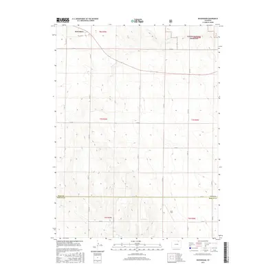
2016 Map of Buckingham
USGS Topo · Published 2016About this map
Buckingham sits in the northwest corner of this Colorado high plains landscape, defined by a rigid grid of county roads that crisscross the expansive terrain of the Pawnee National Grassland. The map illustrates a strictly managed agricultural and ranching environment where the Weld Co Morgan Co border divides the township sections. Water is a scarce and vital element in this region, represented by the ephemeral paths of Pawnee Cr and Wildcat Cr, which cut subtle drainage patterns through the contours. Aside from the small cluster at Buckingham, the area is largely composed of open acreage, including Wirth Field, reflecting the late-20th and early-21st-century character of the western steppe where large-scale land management and a sparse population define the local economy and geography.
Find a feature on this map
30 named features on this map. Tap any name to fly to it.
Don’t see what you’re looking for? This feature index may not catch every label — zoom into the map to look around manually.
Map Details
Editions of this 2016 Buckingham Map
This is the sole edition of this map. No revisions or reprints were ever made.
Other maps of this area

1951 · Sunken Lake
USGS Topo · 1:24,000

1951 · Peace Valley School
USGS Topo · 1:24,000

1951 · Judson Hills
USGS Topo · 1:24,000

1954 · Sterling
USGS Topo · 1:250,000

1954 · Greeley
USGS Topo · 1:250,000

1957 · Greeley
USGS Topo · 1:250,000

1958 · Greeley
USGS Topo · 1:250,000

1958 · Sterling
USGS Topo · 1:250,000

1961 · Greeley
USGS Topo · 1:250,000

1964 · Greeley
USGS Topo · 1:250,000