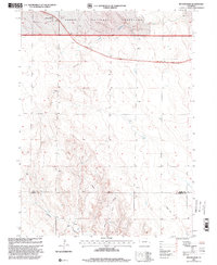
1997 Map of Buckingham
USGS Topo · Published 2000About this map
Buckingham serves as the primary focal point in this high-plains landscape during the late 1990s. The terrain is defined by the sweeping expanse of the Pawnee National Grassland, where the drainage patterns of Pawnee Creek and Wildcat Creek cut through the arid soil. This map illustrates a working landscape integrated with modern infrastructure, marked by a pervasive network of energy extraction sites including numerous Oil Wells and a Gas Well.
Find a feature on this map
13 named features on this map. Tap any name to fly to it.
Don’t see what you’re looking for? This feature index may not catch every label — zoom into the map to look around manually.
Map Details
Editions of this 1997 Buckingham Map
This is the sole edition of this map. No revisions or reprints were ever made.
Other maps of this area

1951 · Sunken Lake
USGS Topo · 1:24,000

1951 · Peace Valley School
USGS Topo · 1:24,000

1951 · Judson Hills
USGS Topo · 1:24,000

1954 · Sterling
USGS Topo · 1:250,000

1954 · Greeley
USGS Topo · 1:250,000

1957 · Greeley
USGS Topo · 1:250,000

1958 · Greeley
USGS Topo · 1:250,000

1958 · Sterling
USGS Topo · 1:250,000

1961 · Greeley
USGS Topo · 1:250,000

1964 · Greeley
USGS Topo · 1:250,000