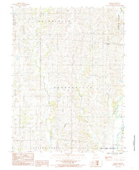
2021 Map of Bucklin NW
USGS Topo · Published 2021About this map
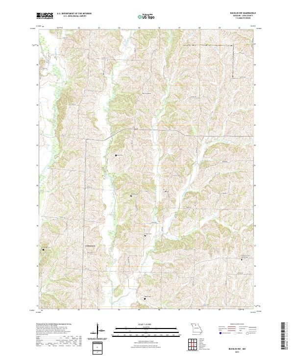
Johnstown anchors this northern Linn County landscape, where the drainage patterns of W Yellow Cr and E Yellow Cr shape the local topography. This 2021 survey illustrates a region defined by its rural road network and scattered family landmarks, providing a clear record of local geography. Numerous small cemeteries are preserved throughout the area, including Baugher Cem, Wyant Cem, and the Pleasant Grove Baptist Cem to the southeast. The map details the intricate path of Winigan Cr as it flows southward, joined by smaller tributaries like Hamilton Br and New Boston Br. For those researching family history in the region, the placement of these burial grounds and named water bodies offers a precise look at the historic rural fabric of northern Missouri.
Find a feature on this map
48 named features on this map. Tap any name to fly to it.
Don’t see what you’re looking for? This feature index may not catch every label — zoom into the map to look around manually.
Map Details
Editions of this 2021 Bucklin NW Map
This is the sole edition of this map. No revisions or reprints were ever made.
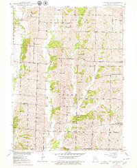
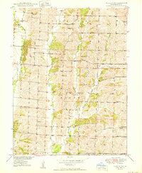
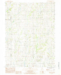
Historical Maps of Johnstown Through Time
7 maps found