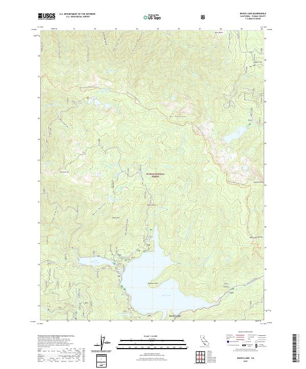
2021 Map of Bucks Lake
USGS Topo · Published 2021About this map
Plumas National Forest encompasses this high-elevation landscape, where the waters of Bucks Lake and the Lower Bucks Lake reservoir dominate the southern terrain. This 2021 survey illustrates a region defined by recreational hubs like Bucks Lodge and the industrial presence of the Bucks Penstock. The drainage patterns are intricate, with numerous named ravines such as Boring Mill Ravine, Bear Ravine, and Pat Maloy Ravine feeding into the local creek system.
Find a feature on this map
56 named features on this map. Tap any name to fly to it.
Don’t see what you’re looking for? This feature index may not catch every label — zoom into the map to look around manually.
Map Details
Editions of this 2021 Bucks Lake Map
This is the sole edition of this map. No revisions or reprints were ever made.
Other maps of this area

1886 · Lassen Peak
USGS Topo · 1:250,000

1888 · Bidwell Bar
USGS Topo · 1:125,000

1891 · Bidwell Bar
USGS Topo · 1:125,000

1892 · Lassen Peak
USGS Topo · 1:250,000

1893 · Bidwell Bar
USGS Topo · 1:125,000

1894 · Lassen Peak
USGS Topo · 1:250,000

1895 · Bidwell Bar
USGS Topo · 1:125,000

1897 · Bidwell Bar
USGS Topo · 1:125,000

1950 · Bucks Lake
USGS Topo · 1:62,500

1955 · Almanor
USGS Topo · 1:62,500