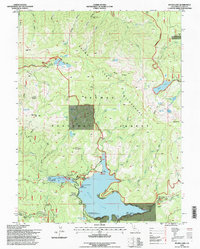
1994 Map of Bucks Lake
USGS Topo · Published 1998About this map
Bucks Lake and the surrounding wilderness of the Plumas National Forest define this high-elevation landscape as it appeared in the late 20th century. The map documents a blend of forest management and recreational development, anchored by the Bucks Lake Summer Home Tract and the Lakeshore Resort. These sites, along with the Bucks Lake Lodge, illustrate the area's role as a seasonal retreat. Hydrological management is evident at the west end of the basin, where the Bucks Diversion Dam and an Intake Tower regulate the waters of Lower Bucks Lake.
Find a feature on this map
58 named features on this map. Tap any name to fly to it.
Don’t see what you’re looking for? This feature index may not catch every label — zoom into the map to look around manually.
Map Details
Editions of this 1994 Bucks Lake Map
This is the sole edition of this map. No revisions or reprints were ever made.
Other maps of this area

1886 · Lassen Peak
USGS Topo · 1:250,000

1888 · Bidwell Bar
USGS Topo · 1:125,000

1891 · Bidwell Bar
USGS Topo · 1:125,000

1892 · Lassen Peak
USGS Topo · 1:250,000

1893 · Bidwell Bar
USGS Topo · 1:125,000

1894 · Lassen Peak
USGS Topo · 1:250,000

1895 · Bidwell Bar
USGS Topo · 1:125,000

1897 · Bidwell Bar
USGS Topo · 1:125,000

1950 · Bucks Lake
USGS Topo · 1:62,500

1955 · Almanor
USGS Topo · 1:62,500