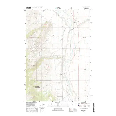
2017 Map of Bucks Nest
USGS Topo · Published 2017About this map
Madison River and Mullison River dominate the central valley of this Madison County landscape, where the braided waterways and irrigation infrastructure like Olsen Ditch define the agricultural and natural character of the region. The map captures a high-elevation environment transitions from the valley floor to the prominent heights of Bucks Nest and Johnny Ridge. Much of the western and southern territory is managed as the Beaverhead National Forest, while the eastern portion includes the Wall Creek Game Range, indicating a landscape dedicated to conservation and public land management. Human presence is marked by rural thoroughfares such as McAtee Rd and the McAtee Bridge, alongside a network of family-named roads like Storey Loop and Armitage Rd that provide access to the drainages of Ruby Cr and Cherry Cr.
Find a feature on this map
39 named features on this map. Tap any name to fly to it.
Don’t see what you’re looking for? This feature index may not catch every label — zoom into the map to look around manually.
Map Details
Editions of this 2017 Bucks Nest Map
This is the sole edition of this map. No revisions or reprints were ever made.
Other maps of this area

1888 · Three Forks
USGS Topo · 1:250,000

1894 · Three Forks
USGS Topo · 1:250,000

1895 · Three Forks
USGS Topo · 1:250,000

1947 · Bozeman
USGS Topo · 1:250,000

1948 · Bozeman
USGS Topo · 1:250,000

1949 · Varney
USGS Topo · 1:62,500

1950 · Cliff Lake
USGS Topo · 1:62,500

1950 · Cameron
USGS Topo · 1:62,500

1950 · Monument Ridge
USGS Topo · 1:62,500

1955 · Bozeman
USGS Topo · 1:250,000