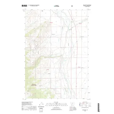
2020 Map of Bucks Nest
USGS Topo · Published 2020About this map
The Madison River dominates the eastern valley floor of this Montana landscape, where human intervention in the water cycle is evident through the Olsen Ditch and Hyde Cr Ditch. To the west, the terrain rises sharply into the high country of the Beaverhead National Forest, culminating in the landmark heights of Bucks Nest. This transition from river bottom to forested ridge is marked by a network of drainage features like Cherry Gulch, Johnny Gulch, and Dry Hollow. Transport across the river is anchored by the McAtee Bridge, connecting the valley to the ranching and forest roads that skirt the base of Johnny Ridge. The map illustrates a classic Western mountain-and-valley economy where water rights and access to high-altitude timber and grazing lands dictate the placement of roads like McAtee Rd and Ruby Creek Rd.
Find a feature on this map
28 named features on this map. Tap any name to fly to it.
Don’t see what you’re looking for? This feature index may not catch every label — zoom into the map to look around manually.
Map Details
Editions of this 2020 Bucks Nest Map
This is the sole edition of this map. No revisions or reprints were ever made.
Other maps of this area

1888 · Three Forks
USGS Topo · 1:250,000

1894 · Three Forks
USGS Topo · 1:250,000

1895 · Three Forks
USGS Topo · 1:250,000

1947 · Bozeman
USGS Topo · 1:250,000

1948 · Bozeman
USGS Topo · 1:250,000

1949 · Varney
USGS Topo · 1:62,500

1950 · Cliff Lake
USGS Topo · 1:62,500

1950 · Cameron
USGS Topo · 1:62,500

1950 · Monument Ridge
USGS Topo · 1:62,500

1955 · Bozeman
USGS Topo · 1:250,000