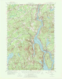
1955 Map of Bucksport
USGS Topo · Published 1972About this map
Penobscot River commerce and industrial history define this mid-century look at the coastal corridor between Hampden and Bucksport. The landscape is shaped by the river's deep channel, flanked by the Bangor and Aroostook Railroad on the western shore and the Fort Knox State Park guarding the narrows at Verona. In the village of Frankfort, a prominent Quarry sits on the slopes of Mt Waldo, signaling the area's history of granite production, while numerous small settlements like Coles Corner and Nealeys Corner mark the rural upland intersections.
Find a feature on this map
131 named features on this map. Tap any name to fly to it.
Don’t see what you’re looking for? This feature index may not catch every label — zoom into the map to look around manually.
Map Details
Editions of this 1955 Bucksport Map
4 editions found
Other maps of this area

1900 · Orland
USGS Topo · 1:62,500

1900 · Bucksport
USGS Topo · 1:62,500

1902 · Orono
USGS Topo · 1:62,500

1902 · Bucksport
USGS Topo · 1:62,500

1902 · Bangor
USGS Topo · 1:62,500

1902 · Castine
USGS Topo · 1:62,500

1904 · Castine
USGS Topo · 1:62,500

1904 · Bluehill
USGS Topo · 1:62,500

1905 · Penobscot Bay
USGS Topo · 1:125,000

1915 · Belfast
USGS Topo · 1:62,500