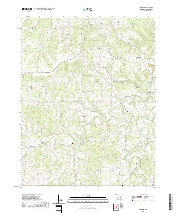
2021 Map of Bucyrus
USGS Topo · Published 2021About this map
Bucyrus and the surrounding Ozark landscape are defined by a complex network of waterways and deep hollows in this 2021 study of Texas County. The terrain is dominated by the course of the Big Piney River and Little Piney River, which carve through the land creating distinctive features like White Rock Bluff and the narrow passage known as The Narrows. Small settlements such as Clara and Dykes are interspersed among the valleys, connected by a web of rural routes including Hwy ZZ and Douglas Rd. Local history is anchored by sites like Emery Chapel Cem and Rocky Branch Cem, which sit near the headwaters of Rocky Br and other seasonal creeks. The mapping reveals a rural landscape where agriculture and natural drainage patterns, like those found in Plum Valley and Hungry Hollow, dictate the placement of homes and roads.
Find a feature on this map
102 named features on this map. Tap any name to fly to it.
Don’t see what you’re looking for? This feature index may not catch every label — zoom into the map to look around manually.
Map Details
Editions of this 2021 Bucyrus Map
This is the sole edition of this map. No revisions or reprints were ever made.
Other maps of this area

1941 · Bado
USGS Topo · 1:62,500

1943 · Bado
USGS Topo · 1:62,500

1945 · Clear Springs
USGS Topo · 1:62,500

1948 · Clear Springs
USGS Topo · 1:62,500

1949 · Rolla
USGS Topo · 1:250,000

1951 · Prescott
USGS Topo · 1:24,000

1951 · Houston
USGS Topo · 1:24,000

1951 · Cabool NW
USGS Topo · 1:24,000

1951 · Cabool NE
USGS Topo · 1:24,000

1951 · Cabool
USGS Topo · 1:62,500