
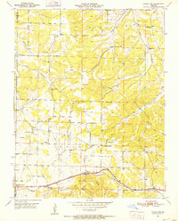
1951 Map of Cabool NW
USGS Topo · Published 1952About this map
Dunn (Impo PO) and the northern edges of Mountain Grove anchor this 1951 topographic study of the Ozark plateau across the Wright and Texas County line. The landscape is defined by a dense network of rural infrastructure, including numerous one-room schoolhouses like Brushy Knob Sch, Mt Zion Sch, and Weatherman Sch that served isolated farmsteads before district consolidation. The St. Louis San Francisco railroad corridor runs along the southern edge, paralleled by small settlements such as Fowler and crossroads like Noels Store. Waterways including Hamilton Creek, Beaver Creek, and West Piney Creek cut through the terrain, with family names preserved in landmarks like Stubbs Cem and Canada Cem. The presence of several Gravel Pits near the rail line suggests the local extraction industry supporting regional road and track maintenance during the early post-war era.
Find a feature on this map
32 named features on this map. Tap any name to fly to it.
Don’t see what you’re looking for? This feature index may not catch every label — zoom into the map to look around manually.
Map Details
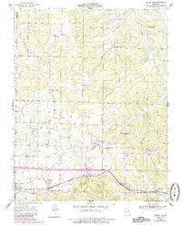
Editions of this 1951 Cabool NW Map
3 editions found
Other maps of this area

1931 · Manes
USGS Topo · 1:48,000

1941 · Manes
USGS Topo · 1:62,500

1941 · Bado
USGS Topo · 1:62,500

1943 · Manes
USGS Topo · 1:62,500

1943 · Bado
USGS Topo · 1:62,500

1950 · Cabool SW
USGS Topo · 1:24,000

1951 · Mountain Grove South
USGS Topo · 1:24,000

1951 · Cabool SE
USGS Topo · 1:24,000

1951 · Mountain Grove North
USGS Topo · 1:24,000

1951 · Cabool NE
USGS Topo · 1:24,000