
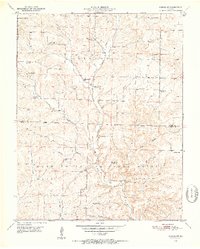
1950 Map of Cabool SW
USGS Topo · Published 1952About this map
The hills of Texas and Douglas Counties in the mid-twentieth century reveal a rural landscape transitioning away from its original network of one-room schoolhouses. While Cherry Point Sch and Shady Grove Sch remain active, several others including Gum Spring Sch and Lone Star Sch are already marked as abandoned, reflecting the consolidation of rural education. The terrain is deeply carved by the North Fork and its tributaries like Panther Creek and East Clifty Creek, where the Mark Twain National Forest boundary meets the agricultural lands of Clinton and Burdine townships.
Find a feature on this map
31 named features on this map. Tap any name to fly to it.
Don’t see what you’re looking for? This feature index may not catch every label — zoom into the map to look around manually.
Map Details
Editions of this 1950 Cabool SW Map
3 editions found
Other maps of this area

1937 · Buckhart
USGS Topo · 1:48,000

1939 · Topaz
USGS Topo · 1:62,500

1941 · Topaz
USGS Topo · 1:62,500

1943 · Buckhart
USGS Topo · 1:62,500

1945 · Harrison
USGS Topo · 1:250,000

1945 · Buckhart
USGS Topo · 1:62,500

1949 · Harrison
USGS Topo · 1:250,000

1951 · Mountain Grove South
USGS Topo · 1:24,000

1951 · Cabool SE
USGS Topo · 1:24,000

1951 · Mountain Grove North
USGS Topo · 1:24,000