
1945 Map of Buckhart
USGS Topo · Published 1945About this map
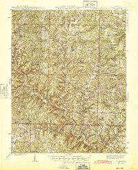
Bryant Creek winds through a dense landscape of hollows and ridges in this mid-century survey of Douglas and Ozark counties. Much of the eastern terrain falls within the Mark Twain National Forest, where high points like Blackjack Knob and Simpson Mtn overlook a network of small upland communities. The map captures an era of localized rural life, evidenced by the high density of district schoolhouses such as Clifty Hall Sch, Stony Point Sch, and Silver Shade Sch, many of which were central to these remote Ozark townships. Along the creek bottoms, settlements like Rockbridge and Buckhart served as focal points for the surrounding hollows. The presence of numerous family cemeteries, including Penner Cem and Eaton Cem, alongside landmarks like Devils Rock Pile, offers significant detail for researchers tracing the family-named landmarks and settlement patterns of southern Missouri.
Find a feature on this map
116 named features on this map. Tap any name to fly to it.
Don’t see what you’re looking for? This feature index may not catch every label — zoom into the map to look around manually.
Map Details
Editions of this 1945 Buckhart Map
2 editions found
Other maps of this area

1934 · Gainesville
USGS Topo · 1:48,000

1936 · Thornfield
USGS Topo · 1:48,000

1936 · Ava
USGS Topo · 1:48,000

1937 · Buckhart
USGS Topo · 1:48,000

1939 · Topaz
USGS Topo · 1:62,500

1940 · Gainesville
USGS Topo · 1:62,500

1941 · Topaz
USGS Topo · 1:62,500

1942 · Ava
USGS Topo · 1:62,500

1943 · Thornfield
USGS Topo · 1:62,500

1943 · Buckhart
USGS Topo · 1:62,500