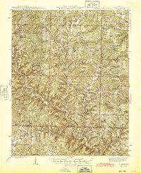
1945 Map of Buckhart
USGS Topo · Published 1945About this map
Mark Twain National Forest dominates the northeast corner of this mid-1940s landscape, where the Ozark Highlands are deeply dissected by the winding courses of Bryant Creek and the North Fork White River. The settlement pattern follows the intricate ridge and valley systems, with small communities like Buckhart, Vanzant, and Rockbridge serving as local anchors. This era represents a time when the rural schoolhouse remained a cornerstone of community life, evidenced by the high density of small institutions such as Clifty Hall School, Turkey Flat School, and Silver Shade School. The terrain is marked by distinctive local landmarks, including Brown Cave and the prominent Twin Knobs. In the southwest, Barren Fork and Barker Creek drain the hills near Souder, reflecting a traditional agricultural and timber-based economy established well before the modern consolidation of these rural townships.
Find a feature on this map
73 named features on this map. Tap any name to fly to it.
Don’t see what you’re looking for? This feature index may not catch every label — zoom into the map to look around manually.
Map Details
Editions of this 1945 Buckhart Map
2 editions found

Other maps of this area

1934 · Gainesville
USGS Topo · 1:48,000

1936 · Thornfield
USGS Topo · 1:48,000

1936 · Ava
USGS Topo · 1:48,000

1937 · Buckhart
USGS Topo · 1:48,000

1939 · Topaz
USGS Topo · 1:62,500

1940 · Gainesville
USGS Topo · 1:62,500

1941 · Topaz
USGS Topo · 1:62,500

1942 · Ava
USGS Topo · 1:62,500

1943 · Thornfield
USGS Topo · 1:62,500

1943 · Buckhart
USGS Topo · 1:62,500