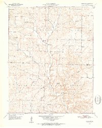
1950 Map of Cabool SW
USGS Topo · Published 1952About this map
Mark Twain National Forest dominates the southern landscape of this Ozark survey, where the North Fork River carves its way through the rugged terrain of Douglas and Texas Counties. The map reveals a mid-century rural network transitioning as several small community centers show signs of consolidation. Numerous local schools, such as Gum Spring Sch and Excelsior Sch, are noted as abandoned, while institutions like Shady Grove Sch and Cherry Point Sch remained active at the time of the 1950 field check.
Find a feature on this map
31 named features on this map. Tap any name to fly to it.
Don’t see what you’re looking for? This feature index may not catch every label — zoom into the map to look around manually.
Map Details
Editions of this 1950 Cabool SW Map
3 editions found
Other maps of this area

1937 · Buckhart
USGS Topo · 1:48,000

1939 · Topaz
USGS Topo · 1:62,500

1941 · Topaz
USGS Topo · 1:62,500

1943 · Buckhart
USGS Topo · 1:62,500

1945 · Harrison
USGS Topo · 1:250,000

1945 · Buckhart
USGS Topo · 1:62,500

1949 · Harrison
USGS Topo · 1:250,000

1950 · Cabool SW
USGS Topo · 1:24,000

1951 · Mountain Grove South
USGS Topo · 1:24,000

1951 · Cabool SE
USGS Topo · 1:24,000