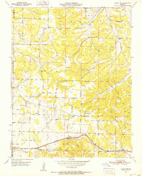
1951 Map of Cabool NW
USGS Topo · Published 1952About this map
The Ozark plateau north of Mountain Grove is defined by a network of rural schoolhouses and country churches that anchored the small farming communities of the early 1950s. Along the St. Louis San Francisco rail line at the southern edge of the sheet, the settlement of Dunn (Impo PO) and Walnut Grove Sch serve as landmarks for the river-and-rail economy of the day. The topography is deeply incised by the Big Piney River and its many tributaries, including Hamilton Creek and Van Zant Creek.
Find a feature on this map
32 named features on this map. Tap any name to fly to it.
Don’t see what you’re looking for? This feature index may not catch every label — zoom into the map to look around manually.
Map Details
Editions of this 1951 Cabool NW Map
3 editions found
Other maps of this area

1931 · Manes
USGS Topo · 1:48,000

1941 · Manes
USGS Topo · 1:62,500

1941 · Bado
USGS Topo · 1:62,500

1943 · Manes
USGS Topo · 1:62,500

1943 · Bado
USGS Topo · 1:62,500

1950 · Cabool SW
USGS Topo · 1:24,000

1951 · Mountain Grove South
USGS Topo · 1:24,000

1951 · Cabool SE
USGS Topo · 1:24,000

1951 · Mountain Grove North
USGS Topo · 1:24,000

1951 · Cabool NW
USGS Topo · 1:24,000